
 Subscribe vis RSS
Historical Topography ~ Friday, June 15, 2007
In the 2nd grade I rode the SF Muni's 26 Valencia bus to Glen Park Elementary school.
30 or so years later, I learned that the 26's quirky ride through hilly backstreets followed the original route of the San Francisco & San Mateo interurban line's southerly exit from the City--all the flatter and straighter routes had been taken by other streetcar companies!
I remember that just before the bus got to my stop, it turned a corner, and went through a little dip on Diamond St, a short block or two with corner stores, etc.
Here's what it looks like today.
The bus in the middle of the picture is right where I'm talking about. The modern building above it is the Glen Park BART station; behind it is San Jose Ave, with the Muni J-Church light rail line in the median. In the upper right is my old school. Scroll to the right, and you'll see Glen Canyon Park.
Browsing the online Historical Image Collection of the SF Public Library, happened across these two pictures: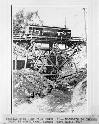
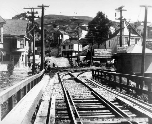
This whole stretch of Diamond St is built on a filled in gully--which the United Railroads of SF/Market St. Ry. bridged on this spindly wooden trestle.
After I posted these pictures to the SFMuniHistory group, member Art Curtis took this picture of the scene today, which I'm posting here with his permission:
The gully is long gone, but a lot of those distinctly San Franciscoish buildings are exactly the same.